


ATAK-CIV (Civil Use)
3.7289.00 Reviews
App Specs
- Version
- 5.6.0.12 (9c9a5897)[playstore]
- Updated On
- License
- Free
- Downloads
- 500,000+
- Developer
- TAK Product Center
- Categories
- Maps & Navigation
- Platform
- Android
Screenshots
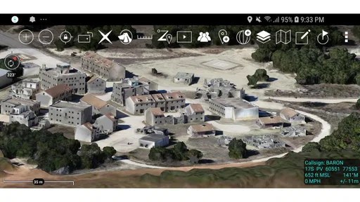
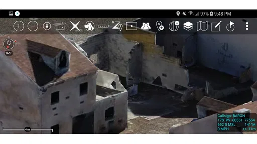
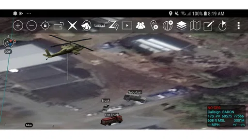
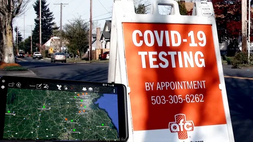
 Analysis by AppCompare
ATAK-CIV is an unusual free navigation app because its main value is not simply showing me where I am. Its focus is shared geospatial and situational awareness: turning a map into a common workspace where location, context, and field information can be understood together. That makes it far more specialized than a typical driving or walking navigator, and it also explains why the experience can feel powerful in one situation and excessive in another.
I reviewed it as an Android app from TAK Product Center, listed under Maps & Navigation. The current release is version 5.6.0.12 (9c9a5897)[playstore], and it works from Android 5.0 onward. It is free to install, carries a Teen content rating, and has passed the half-million-install mark. Those details make it accessible to a wide range of Android users, but accessibility should not be confused with simplicity: this is a tool that rewards preparation and a clear reason for using it.
Why shared situational awareness is the real feature
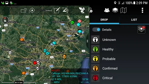
The capability that matters most here is the ability to treat a map as a live operational picture rather than a passive background. In a normal navigation app, I usually ask one question: how do I get from my current position to a destination? ATAK-CIV is better suited to a broader question: what is happening around this area, where are the relevant points, and how can everyone working from the same information understand the situation?
That difference changes the way I think about navigation. Instead of relying only on a route line, I can use a geographic view to organize places, observations, hazards, meeting points, boundaries, or other information relevant to the task at hand. The map becomes a reference that supports decisions, not merely a voice-guided path to a shop or address.
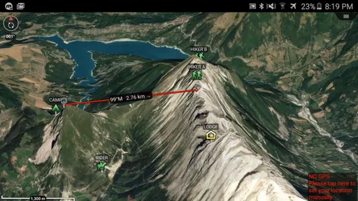
This is why the app can appeal to field teams, search-and-rescue volunteers, emergency planners, outdoor groups, and people coordinating work across a large or changing area. A group may need to discuss a location precisely, compare what each person is seeing, and keep a shared understanding of the terrain. In that context, the app’s central idea is much more useful than the familiar “turn left at the next street” model.
The practical effect is a reduction in ambiguity. Saying “I am near the north side of the trail” leaves room for interpretation. Referring to a point on the same map gives the group something concrete to discuss. That sounds like a small improvement, but in a confusing outdoor setting, during an incident, or while coordinating several people, a shared geographic reference can prevent wasted time and duplicated effort.
I also appreciate that this approach encourages users to think spatially. Rather than keeping notes in one app, messages in another, and locations in a third, the work can be organized around the map. The advantage is not that every task becomes easier immediately. The advantage is that location remains connected to the information being discussed, which is exactly what ordinary messaging and navigation tools often handle poorly.
Worth Reading Before You Choose

EA SPORTS FC Mobile 26 Is a Bigger Football Game, but It Takes Time

Flipboard Shows What News Apps Must Do Beyond the Feed

Switching to Android Auto Means Rethinking Your Driving Routine

Google Calendar Makes a Crowded Week Easier to Manage

Ludo King Makes the Most of the Minutes Between Plans

Baby Panda World Brings Quick Play to Modern Phones, but Its Game Library Feels Busy
A map for decisions, not just directions
Traditional navigation apps are excellent when the destination is known and the route is the main problem. They tend to prioritize convenience, traffic, addresses, and estimated arrival times. ATAK-CIV belongs to a different family of tools. Its strength is the relationship between people, places, and changing conditions.
That distinction matters before installation. If I only want reliable directions to a new restaurant, I would choose a conventional navigation service. If I am coordinating a group in an area where the important question is “what is located where, and how do we keep everyone oriented around the same picture?”, this app makes much more sense.
The same capability can also be useful for planning before anyone moves. A team can look at the area, decide which locations matter, and agree on how to describe them. This is a more deliberate workflow than opening a map only after something goes wrong. The app rewards users who prepare a geographic plan instead of expecting the software to make every decision for them.
The biggest strength is shared context: a location is more useful when everyone can interpret it against the same map and the same operational purpose. That is the part of ATAK-CIV that feels genuinely different from mainstream map apps.
How the workflow feels in practice
My first impression is that ATAK-CIV asks more from the user than a consumer navigation app. There is a learning curve because the app is designed around situational awareness rather than casual browsing. The interface makes more sense when I begin with a specific field objective: identify an area, organize relevant points, communicate a position, or support a team’s shared understanding.
That purpose-first approach is important. Opening the app without knowing what I want to represent on the map can make the experience feel busy. Before using it with other people, I would spend time learning the map view, deciding what information matters, and agreeing on a simple naming or marking convention. A few minutes of preparation can make the difference between a useful shared picture and a cluttered screen that nobody interprets consistently.
One of the more valuable habits is separating essential information from background detail. A field map can become less helpful when every possible point is treated as equally important. I would keep the working view focused on the locations and conditions that affect the current task, while maintaining a separate planning mindset for information that may become relevant later. This is not a flashy feature; it is a practical discipline that makes the app easier to use under pressure.
Another useful workflow is to use the app before, during, and after an activity. Beforehand, I can establish the area of interest and decide what the team needs to recognize. During the activity, the geographic view helps people stay oriented and discuss positions. Afterwards, the same map-based thinking can help reconstruct what happened, where attention was needed, and which parts of the plan should change next time.
This makes the app more than a one-time navigation aid. It can become a shared workspace for a continuing operation. However, that benefit depends heavily on consistent use. If one person records information carefully while everyone else communicates through vague messages, the advantage is reduced. ATAK-CIV works best when the group agrees that the map is the common reference point.
What I would prepare before relying on it
I would not install this immediately before leaving for a demanding trip and assume I could learn it while moving. The better approach is to test it in a familiar area, create a small practice scenario, and make sure the people involved understand how they will use the map. This is especially important for users who are accustomed to consumer apps that hide most of the underlying complexity.
I would also check the device itself before heading out. A map-centered field tool depends on the phone being usable when the user needs it, so battery condition, screen visibility, storage, and general device readiness matter. Those are not glamorous considerations, but they are more important than installing another app at the last moment.
For a group, I would establish a short set of rules: what information belongs on the shared map, how locations will be described, who is responsible for updates, and what the team should do if the map is no longer current. Without those rules, a shared map can create false confidence. Seeing information on a screen does not automatically mean that information is complete or still accurate.
That last point is central to using the app responsibly. ATAK-CIV can organize awareness, but it cannot replace judgment. If conditions change, users must recognize that the digital picture may lag behind reality. The app helps people communicate and reason about geography; it should not be treated as an unquestionable authority.
The scenario where ATAK-CIV makes the most sense
The strongest everyday example I can imagine is a volunteer search effort in a large outdoor area. A coordinator needs to keep several people oriented, discuss locations precisely, and maintain a common understanding of which parts of the area have received attention. A standard map can show roads and trails, while a messaging app can carry instructions, but the group still has to translate every message into geography.
With ATAK-CIV as the shared map, the conversation can stay tied to the area itself. A volunteer can refer to a specific point or zone, another person can understand its position in relation to the rest of the team, and the coordinator can reason about coverage rather than juggling disconnected descriptions. The benefit is not simply speed. It is fewer misunderstandings about where something is and what still needs attention.
There is a similar use case for outdoor event coordination. Imagine a group managing checkpoints, access areas, medical locations, and meeting points across a spread-out site. A conventional navigation app may help an individual reach an address, but it is not designed around the team’s shared operational picture. ATAK-CIV is more appropriate when the map needs to express relationships among several locations and people.
It can also help with pre-trip planning for a remote outing. A group could study the area, identify important reference points, and agree on how to communicate if members separate. The value here is preparation: everyone begins with the same geographic vocabulary instead of improvising descriptions when visibility, stress, or unfamiliar terrain makes communication harder.
Even in these scenarios, I would use it as one part of a broader safety plan. A digital map does not eliminate the need for local knowledge, sensible decisions, communication backups, or awareness of changing conditions. The app is most useful when it improves coordination without encouraging users to ignore the physical environment around them.
When a normal map app is the better choice
For ordinary commuting, errands, restaurant searches, traffic-aware driving, or casual sightseeing, ATAK-CIV would not be my first recommendation. A mainstream navigation app is usually faster to understand and better aligned with those goals. It presents the information most people want immediately, without asking them to build a workflow around situational awareness.
I would also hesitate to recommend it to someone who wants a completely hands-off navigation experience. The app’s value comes from active interpretation: deciding what matters, organizing geographic information, and using the map as part of a plan. If that sounds like unnecessary work for your use case, the extra capability will feel like friction rather than an advantage.
There is a trade-off between depth and approachability here. ATAK-CIV can support a more deliberate way of working with location, but that depth means the first session may not feel as smooth as opening a familiar consumer map. Users should choose it because they need the specialized capability, not because they expect every map app to behave the same way.
Trade-offs that become clear after real use
The most obvious limitation is the learning curve. The app’s purpose is clear once I think in terms of shared awareness, but the path to becoming comfortable is not as immediate as it is with a basic route planner. New users need to understand not only where they are on the map, but also how the map supports the team’s decisions.
A second trade-off is the risk of information overload. A map can hold a great deal of context, yet more information does not always produce better awareness. If users add points without a clear reason, important details can become difficult to find. My practical advice is to begin with the smallest useful map: only the locations and references needed for the current task. Add complexity when the team can explain why it improves the decision-making process.
A third issue is the difference between shared information and verified reality. A common map can make a team feel coordinated, but coordination is not the same as accuracy. If an observation is old, incomplete, or misunderstood, presenting it neatly does not correct the underlying problem. Teams should treat map information as something to evaluate, update, and discuss rather than something automatically trustworthy.
There is also a social trade-off. The app can improve communication when everyone participates in the same geographic workflow, but it may complicate a group if only one person understands how to use it. I would train at least one backup user and agree on a simple verbal fallback for important locations. That keeps the map from becoming a single point of dependence.
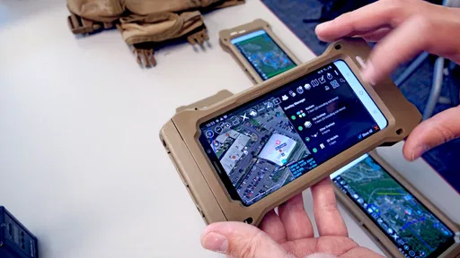
Device limitations matter as well. A phone with a small screen, weak battery, or poor outdoor visibility can make map work tiring. The application may be capable, but the experience still depends on the hardware in my hand and the conditions around me. For demanding field use, I would test the complete setup rather than judging the app in a comfortable indoor setting.
The free price is a meaningful advantage for experimentation and team planning, especially when a group wants to evaluate a specialized tool without committing to a subscription. At the same time, free access does not remove the need for training and preparation. The cost is low, but the attention required to use the app well is higher than with a casual map.
Its Teen rating is also worth noticing for families and organizations deciding who should use it. That rating does not tell me whether the app fits a particular activity, but it reinforces that this is not presented as a children’s mapping toy. It is better approached as a serious geographic tool that requires responsible handling and sensible supervision where appropriate.
Who gains the most from this app
The best audience is anyone who needs more than a route from one address to another. Search-and-rescue volunteers, outdoor coordinators, emergency-preparedness groups, field researchers, and teams working across a defined area are the people I would point toward it first. They can benefit from keeping location at the center of planning and communication.
It is especially suitable for users who enjoy structured preparation. If you are willing to practice in advance, define what information matters, and teach the workflow to your group, the app can become a strong coordination aid. The benefit grows when several people use the same geographic language instead of keeping separate notes and interpretations.
It is less suitable for someone who wants a polished, low-effort replacement for a standard navigation app. Drivers looking for traffic guidance, travelers searching for businesses, and pedestrians who mainly need simple directions will probably be happier with a conventional alternative. ATAK-CIV is not a better version of those tools; it solves a different problem.
Its audience also needs to be comfortable making decisions rather than following the screen blindly. The app can help organize observations and locations, but the user remains responsible for understanding the environment and recognizing when information may be incomplete. That makes judgment and training just as important as the software itself.
The public response suggests a reasonably established Android presence, with an average rating of 3.7 from around 1.7 thousand ratings and 289 written reviews. I would read that as a sign of a specialized app with a mixed but meaningful reception rather than a universally effortless experience. The rating fits my own conclusion: the right users can find real value here, while casual map users may encounter more complexity than they need.
After using it, I see ATAK-CIV as a focused instrument rather than an all-purpose map replacement. Its defining strength is the way it supports a common geographic picture, particularly when a group must coordinate people, places, and changing circumstances. That capability can make a real difference in field planning and organized response.
My recommendation is straightforward. Choose it if your work or outdoor activity depends on shared situational awareness and you are prepared to learn a deliberate map-based workflow. Skip it if your goal is simply quick directions or effortless local search. For the right team, this free app from TAK Product Center can turn a map into a practical coordination space; for everyone else, its specialized design may be more work than the problem requires.
Pros
- Powerful offline mapping and navigation capabilities
- Supports detailed situational awareness and team coordination
- Works with many plugins and external data sources
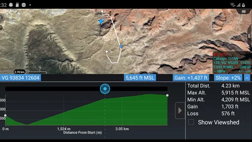
- Can display tracks
- markers
- routes
- and geographic overlays
- Useful for search and rescue
- fieldwork
- and emergency response
Cons
- Steep learning curve for first-time users
- Interface can feel crowded on smaller phone screens
- Some advanced features require additional plugins or setup
- May consume significant battery during GPS-intensive use
- Best results often require compatible maps and data packages
FAQs for ATAK-CIV (Civil Use)
What is ATAK-CIV (Civil Use), and who is it designed for?
ATAK-CIV is a geospatial situational-awareness and mapping application for Android devices. It is designed for civilian users who need to view maps, mark locations, share information, plan routes, and coordinate activities in the field. It can be useful for search-and-rescue teams, emergency responders, outdoor groups, disaster-relief organizations, and other authorized teams working in areas where accurate location information is important.
Does ATAK-CIV require an internet connection to work?
ATAK-CIV can support offline use, but the exact experience depends on the maps, data packages, and plugins installed before going into the field. Online access may be needed to download or update map layers, exchange information through configured services, or use certain network-based features. Users should test their selected maps and tools in advance, because offline availability is not automatic for every feature.
What features are available in ATAK-CIV?
The application provides tools for displaying maps, recording and sharing points, drawing routes and areas, measuring distances, tracking movement, and exchanging operational information with compatible users or systems. Its capabilities can be expanded through supported plugins and configured data sources. However, available functions may vary according to the device, installed extensions, map packages, permissions, and the network environment used by the team.
Is ATAK-CIV easy for beginners to use?
ATAK-CIV offers powerful tools, but it is more specialized than a typical navigation app. New users may need time to understand map layers, symbols, coordinate formats, data sharing, plugin management, and the application’s many menus. A short training session and practice in a safe environment are strongly recommended. Teams should also establish common settings and procedures before relying on the app during an operation.
Is ATAK-CIV safe and suitable for sensitive operational information?
ATAK-CIV includes capabilities that can support secure, controlled information sharing, but security depends heavily on how the application is configured and deployed. Users should obtain it from a trusted source, keep the app and device updated, protect the device with a strong lock method, and follow their organization’s rules for sensitive data. Do not assume that every connection or plugin is secure without verification.


